Flash floods can occur quickly. Drainage systems that were dry before a large storm can turn into torrents of water within minutes. Therefore, people who live or work near such areas may not have enough time to respond. Water level monitoring is the technology that changes this situation. By providing real-time information on water levels in drains, as well as continuous tracking systems, emergency managers and city engineers can receive ample warning of impending flash-flood conditions. This blog will cover how smart cities are managing stormwater and creating climate-resilient infrastructure by using water-level detection systems to reduce flash-flood damage.
Contents
Why Traditional Stormwater Management Is No Longer Enough?
Urban stormwater management has historically relied on physical infrastructure, pipes, drains, retention basins, and pumping stations, designed around historical rainfall averages. However, climate change is making those historical averages increasingly unreliable. Extreme rainfall events are becoming more frequent and more intense, pushing drainage infrastructure beyond its designed capacity at exactly the moments when it matters most.
Furthermore, traditional systems rely on manual inspection and reactive responses. By the time a field officer identifies a blocked drain or an overflowing retention basin, significant damage may already be underway. Stormwater runoff also poses a secondary problem. It picks up pollutants. This includes heavy metals, hydrocarbons, and pesticides from road surfaces. And this makes monitoring alongside level detection essential for protecting downstream waterways and urban ecosystems.
● The Cost of Getting It Wrong
The financial and human cost of urban flooding is substantial. Flooded roads disrupt emergency services. Inundated properties face structural damage and mold remediation costs. Critical infrastructure, such as substations, tunnels, and underpasses, faces catastrophic damage when water levels rise undetected.
Smart cities recognize that investing in continuous water-level detection infrastructure costs a fraction of what a single significant flood event would cost to remediate.
How Smart Cities Use Water Level Monitoring?
Modern stormwater management depends on networked sensor systems that continuously measure water levels across multiple points in a catchment and transmit. When water levels approach pre-set thresholds, automated alerts notify engineers and emergency managers. This provides actionable warning time before conditions deteriorate.
● Real-Time Sensor Networks Across the Catchment
Effective urban stormwater monitoring deploys temp sensors at key points, including inlet structures, culverts, retention ponds, low-lying road underpasses, and urban waterways. Each sensor continuously measures water depth using hydrostatic pressure or ultrasonic technology, transmitting readings via cellular or Wi-Fi networks to cloud platforms.
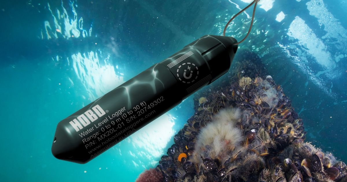
The HOBO MicroRX Water Level Station, available through One Temp, is a recognized leader in this space. Its pre-programmed water-flow formulas for weirs and flumes eliminate the need for complicated manual calculations, and its cloud integration delivers near-real-time data access from any location.
Additionally, the EM500-SWL LoRaWAN liquid-level sensor supports monitoring of rivers, dams, retention ponds, and water tanks, with a battery life of up to 10 years. This makes it ideal for remote or difficult-to-access stormwater infrastructure where regular maintenance is impractical.
● Automated Alerts Replace Manual Patrols
One of the most operationally significant advantages of continuous water level monitoring is the elimination of reactive, manual patrol systems. Instead of deploying staff to check drainage infrastructure, smart city operations centers receive automated threshold alerts the moment water levels approach dangerous levels.
Research published in the Smart Cities journal in 2025 found that AI-integrated flood control systems improved pump operation efficiency by 45.4% compared to traditional manual control methods. When water level sensors feed real-time data into automated pump control systems, urban flood management shifts from reactive to genuinely proactive. This adjusts drainage infrastructure in real time based on what sensors are actually measuring across the catchment.
Role of Complementary Sensors in a Complete Stormwater System
Water level data alone tells part of the story. A complete stormwater monitoring system integrates multiple sensor types that work together to provide operators with a comprehensive picture of conditions across the catchment.
● Temperature Sensors and Rainfall
Temperature sensors provide environmental context alongside water-level readings. Particularly relevant for monitoring the thermal behavior of stormwater systems and detecting conditions that affect sensor accuracy. Sensors for temperature integrated with HOBO Remote Monitoring Stations allow operators to track barometric pressure alongside water level. This enables barometric compensation, which significantly improves the accuracy of pressure-based water-level measurements.
● Water Quality Detection for Environmental Compliance
The Water quality Monitoring alongside level detection helps councils and environmental agencies track pollutant loads in stormwater discharges. Turbidity sensors, conductivity probes, and dissolved oxygen sensors deployed alongside water level loggers provide the data needed to assess environmental impact.
● Soil Moisture Detector Integration
A soil moisture detector network across the catchment upstream of urban drainage infrastructure provides critical early warning data. When soils are already saturated from prior rainfall events, even moderate subsequent rainfall generates rapid runoff with little absorption. Integrating soil moisture sensor readings with water-level detection enables smart city systems to dynamically adjust alert thresholds. This involves treating a moderate rainfall event as high risk when the catchment is already saturated, rather than applying static thresholds.
Choosing the Right Water Level Monitoring Solution
Not every stormwater monitoring application requires the same solution. The right choice depends on site accessibility, required measurement accuracy, communication infrastructure, power availability, and deployment environment.
For accessible urban infrastructure with existing power and cellular coverage, the HOBO MicroRX Water Level Station offers the most complete solution. This includes cellular connectivity, cloud integration, automated alerts, and pre-programmed flow calculations in a single deployable unit.
For remote or difficult-access sites, LoRaWAN-enabled sensors like the EM500-SWL provide a decade of battery-powered operation with reliable data transmission over several kilometers. This covers rural catchments, roadside culverts, and regional flood-warning networks that fall outside cellular coverage.
Building the Infrastructure That Protects What Matters
Flash floods will not stop. Climate patterns will continue to intensify rainfall events across Australian cities and regional centers. However, the gap between a dangerous situation and a managed response becomes significantly smaller when continuous water level monitoring networks are in place.
Smart cities do not wait for water to appear in the streets before they respond. They monitor constantly, alert automatically, and act with the confidence that comes from real-time, accurate data across every sensor in their network.
OneTemp supports councils, engineers, environmental agencies, and researchers across Australia with the full range of water-level detection stations. Their Australian technical team brings over 50 years of monitoring experience to every deployment recommendation.